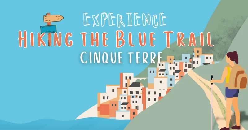
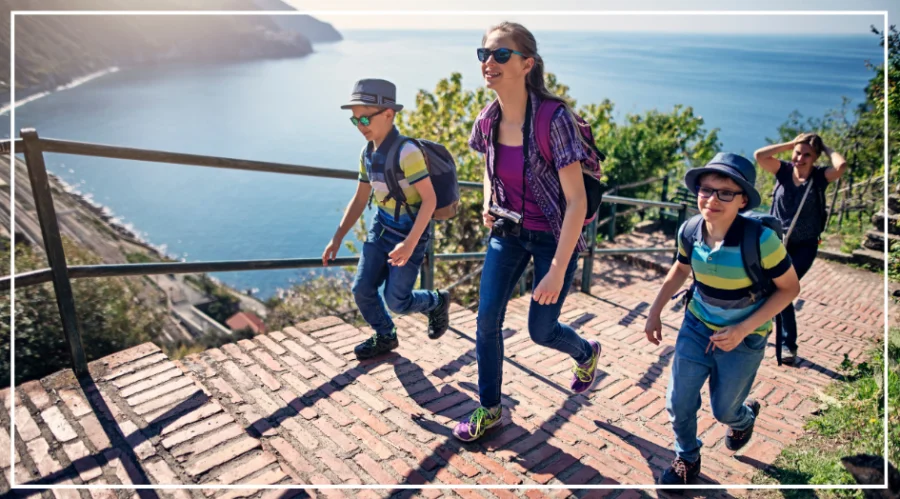
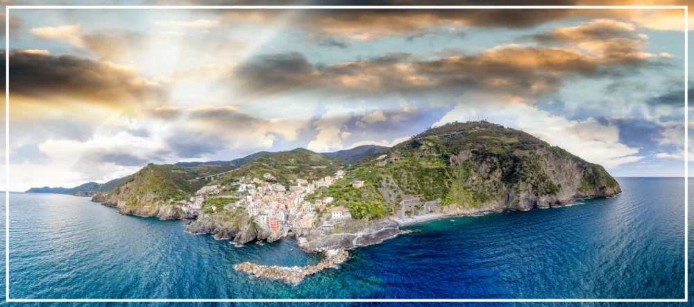
Hiking between the Cinque Terre villages is by far the best way to experience the farming culture and history of the area. You also get some of the most spectacular views as you arrive at the towns from a panoramic position.
The Cinque Terre hiking trails are world famous and no more so than the SVA (Sentiero Verde Azzurro) “Cinque Terre Blue Trail”. The 7 miles (just over 11 km) of trail connecting Riomaggiore to Monterosso is one of Cinque Terre’s must-do attractions.
Being an active hiker myself, it’s hard to imagine visiting Cinque Terre without walking at least one section of the Blue Trail.
Whether you want a quick and easy hike or an all-day adventure, this short guide covers the Cinque Terre hikes of the famous blue trail.
Download the official Cinque Terre trail map (PDF) for all the Cinque Terre Hikes, and don’t forget to read our Cinque Terre travel tips for a smooth trip.
Cinque Terre Blue Trail
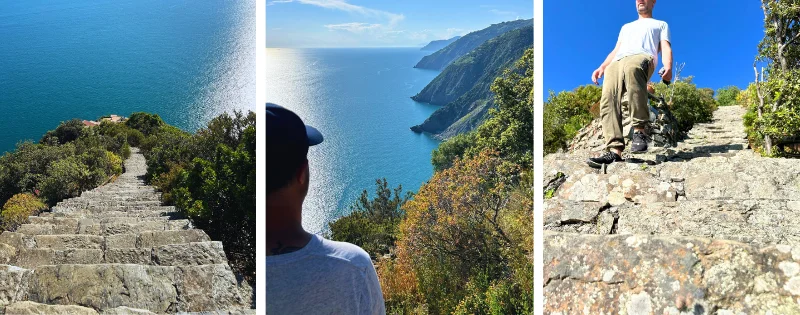
The SVA (Sentiero Verde Azzurro) “Cinque Terre Blue Trail” is the most well-known of the Cinque Terre trails. The path is carved into the steep hillside and impresses hikers with famously beautiful sea views.
The blue trail skims along the Ligurian coast, but the most famous sections run from Riomaggiore to Monterosso.
A magnificent path that every eager hiker wants to experience.
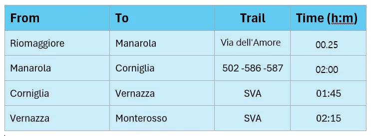
However, the nature of the steep cliffs and wild coastal weather has damaged some sections. For example, the Corniglia-Vernazza section has been closed for a number of years. And the Riomaggiore-Manarola section only reopened last year after 12 years of closure!
So, unfortunately, you can’t walk the entire route. Let’s take a look at the SVA path, route information, and the path's open/closed status.
Blue Trail: Riomaggiore to Manarola (Via dell’Amore - Path of Love)
This section of the SVA path (official designation: 592-1 (SVA2)) is the easiest hike in Cinque Terre. This short flat section of path was built almost 100 years ago during the construction of the railway line. A historical walk that was an important connection between the two village communities.
Trail Statistics
Official Path Number: 592-1 (SVA2)
Grade: Easy
Length: 1.1 km
Duration: 25 minutes
Elevation Gain: Flat Walk
Highlights
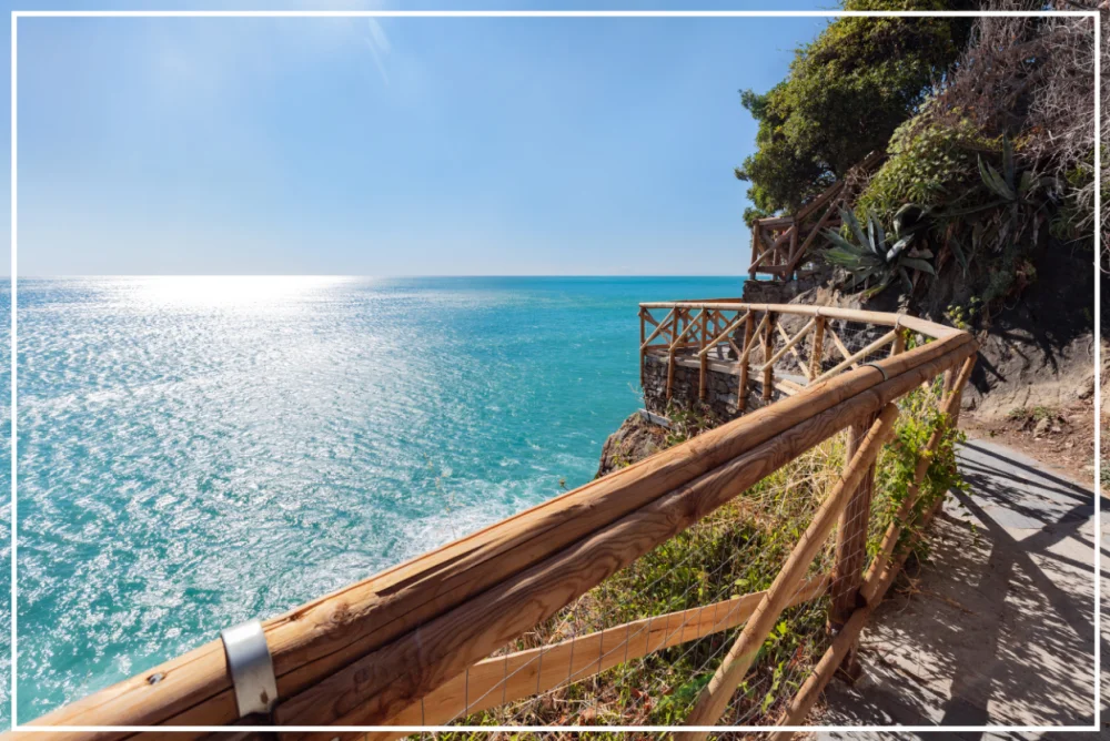
The path skirts the cliff, creating the feeling of floating just above the water. The rugged coastline has been tamed into an easy walking path with expansive sea views.
Route Information
During peak season (April to October), the route can only be done in the Riomaggiore to Manarola direction. Starting in Riomaggiore, you can find the path to the west of the train station.
This is one of the paid paths in the National Park and requires a booked time slot and a ticket. The entry is NOT included in the Cinque Terre trekking card!
Time slots are carefully monitored, and you have a 30-minute period to complete the walk. This is enough time to stroll the path and take pictures.
Read more: Via dell’Amore Path, Tickets and More.
Blue Trail: Manarola to Corniglia
This section of the SVA path has been closed for at least a decade! The last time I was in Manarola (looking down from the promontory), I couldn’t see any positive signs of the path opening for 2025.
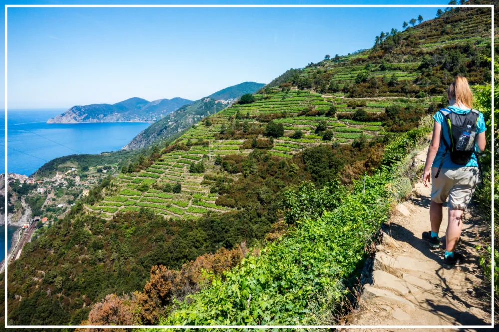
An alternative route winds through the vineyards and the hamlet of Volastra. Start the hike from the western hill overlooking the village. Following the signs for the 502-586-587 hiking trails. This is a difficult two-hour hike with a steep elevation profile.
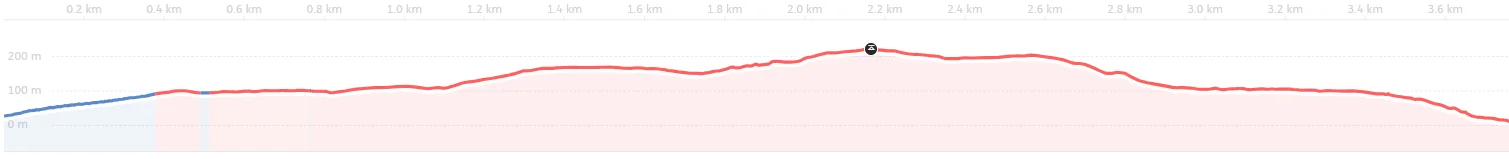
Blue Trail: Corniglia to Vernazza
The SVA path continues from Corniglia onto Vernazza. This difficult hike can be done in either direction. But either way, expect an uneven, rocky path with steep ascents and descents.
Trail Statistics
Official Path Number: 592-3 (SVA2)
Grade: Expert / Difficult
Length: 3.8 km
Duration: 1 hour 45 minutes
Elevation Profile
Highlights
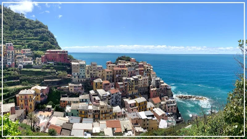
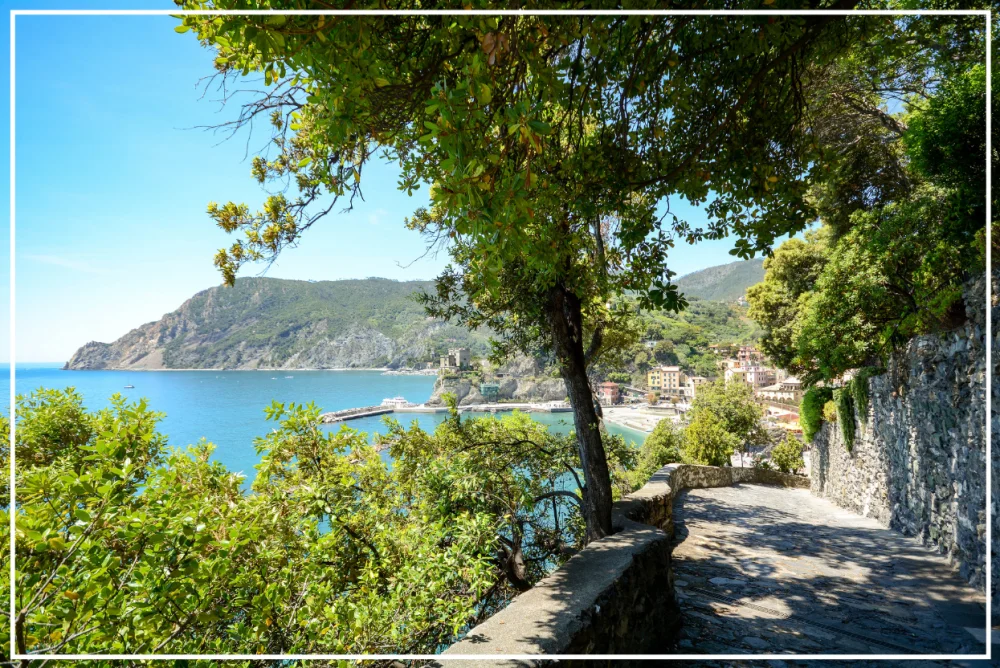
Beautiful coastal views help to distract from your heart pumping and thigh burn. You should also make time to explore the villages at either end. Corniglia has narrow streets and authentic charm. And Vernazza has vibrant energy and a colorful harbor.
Between the two towns, you will find a little gem – Ittiturismo Corniglia SP4488 – an agriturismo where hungry hikers can take a break and enjoy fresh, traditional foods, views, and generous hospitality. A booking is advisable if it’s on your must-do list.
Route Information
From the train station, you will encounter the well-known Lardarina Scalinata – a staircase of 382 steps up to the village. At the top of the stairs, there is a crossroad. Continue straight along the SVA2 using the signage and route to Vernazza.
As you head out of town, you’ll walk along a walled path that cuts through the vineyards for the Cinque Terre DOC wine. After a few minutes, you’ll reach a small road (Via Stazione) and reach a Cinque Terre checkpoint.
Since this is a paid trail, you will need to purchase a trekking card. The Cinque Terre Multiservice Card (all-day train travel card) also includes entry to this trail.
Read More: The full list of inclusions is in our Cinque Terre Card explained article. You can also buy a Cinque Terre Card online for your chosen date(s) to avoid the long queues during peak season.


Blue Trail: Vernazza to Monterosso
The 4th section of the SVA path between Vernazza and Monterosso can be walked in either direction. As with the rest of the Blue Path, expect a variation in the trail with stone steps, clay, rock, and small stones. The path is narrow in parts with steep drop-offs. During peak times, you’ll experience single-file traffic and some bottlenecks.
Trail Statistics
Official Path Number: 592-4 (SVA2)
Grade: Expert / Difficult
Length: 3.5 km
Duration: 2 hour 15 minutes
Elevation Profile
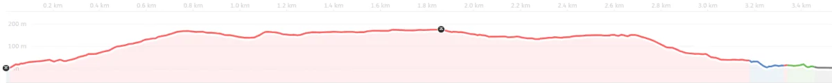
Highlights
As you leave the port village of Vernazza, take time to admire the breathtaking views over the harbor and the 14th-century church of Saint Margaret of Antioch. The views coming into Monterosso are equally captivating.
Route Information
After exploring Vernazza, make your way to the main street (Via Roma), taking the tiny laneway opposite the pharmacy. The laneway rises up out of the village, and the path turns from stone to dirt. It’s here that you’ll also find the Cinque Terre checkpoint.
This paid trial requires a trekking card or Cinque Terre Multiservice Card.
Read More: You can buy a Cinque Terre Card online – save time and avoid the long queues during peak season.
Hiking in Cinque Terre - How to Stay Safe
During June, July, and August, the SVA Blue Trail is popular and busy. The temperatures are typically around 30-35 °C (86- 95°F), and the sun can be brutal.
In the off-season, there are sporadic storms and an increased risk of landslides. The already steep terrain can become treacherous.
It can feel like the great outdoors and Mother Earth are conspiring to make life difficult. But the reality is that nature is unpredictable and wild. Just the way it should be.
Here are my tips for hiking in Cinque Terre:
- Open-toe shoes and/or shoes with smooth soles are not permitted on the Cinque Terre trails.
- There are very few conveniences on the SVA path. So, you should carry what you need. That includes plenty of water, sunblock, and a hat.
- In cold/wet weather, wear suitable clothing and waterproof layers.
- Consider hiking poles for the steeper trails.
- During bad weather, the National Parks office will issue weather alerts and close some of the paths. You can check their website for details.
- Take note of the 112 emergency phone number in case you get into trouble.
How to Make it Extra Special
Stopping along the way to sample the local Cinque Terre DOC wine, pausing to take in the view, snapping a few photos to capture the moment, strolling around the villages, delighting in a seafood lunch, indulging in a cheeky afternoon gelato and taking a dip to cool off at the end of the day.
These are the simple pleasures that will capture the timeless charm of Cinque Terre and its villages.
SVA Hiking Trail Chart
This summary chart is a quick go-to chart so you can check the Blue Trail routes and timings.
Useful Links for Planning Your Hike
Summary
The ancient path known as the Sentiero Azzurro has become world-famous and acclaimed as one of the best hiking experiences in Europe.
Of all the Cinque Terre hikes, the Blue Trail sections connecting Riomaggiore, Manarola, Corniglia, Vernazza, and Monterosso are the most popular, offering unforgettable views and a chance to explore the picture-perfect colored villages.
FAQ
Do I need a permit to hike in Cinque Terre?
You only need a Cinque Terre Card for the main Blue Trail. The Via dell’Amore requires a supplemental ticket available at the National Park welcome centers. Other hiking paths are free.
Are Cinque Terre trails open all year?
Generally speaking, yes, they are; however, the trails can close due to bad weather and maintenance works.
What is the best time to hike in Cinque Terre?
Spring and fall offer cooler weather and fewer crowds. But the weather can be temperamental. Midsummer is popular but hot!
Late May and early June have more stable weather, which isn’t too hot, and the trails are not so busy.
For more detailed information and to help you plan, we have an article on The Best Time of Year to Visit Cinque Terre.
Is the Via dell’Amore open?
Yes, the path commonly known as The Path of Love reopened in 2024. A ticket is required.
Can I hike all five villages in one day?
It's possible to do the Riomaggiore to Monterosso hike in one day. For most, it would be exhausting and more of a fitness challenge than an enjoyable outing.
Most visitors hike one or two sections at a time and take the time to visit the villages at either end of the hike.
It may also depend on how much time you have in Cinque Terre.
What should I wear for hiking?
Sturdy shoes, breathable clothes, sun protection, a sun hat, and layers in cooler months.
Can I hike without a guide?
Absolutely. Trails are marked, and it is all very easy to follow. Stay on the paths and pay attention to the park rules and you'll be just fine.
Are guided hikes worth it?
Yes, especially if you want local insights into some history, culture, and to explore further afield, (or if you worry about getting lost). You can find guided hikes on Get Your Guide and other similar websites.
Can I bring my dog on the trails?
Dogs are allowed but must be leashed. Bring poo bags, water and a bowl for your dog. It’s also common in Italy to carry your dog’s passport (or similar documentation) and a muzzle, especially on public transport.
Is it safe to hike alone in Cinque Terre?
Normally, yes, but check the weather and trail conditions. Carry a phone and hike during daylight hours, when other people are around.